Well Storm Safari 2011 is in the bag. For those of you not familiar with Storm Safari 2011 let me explain. I accompanied Todd Yakoubian from KATV Channel 7 in Little Rock, photojournalist Philip Labuda and storm chaser Erich Hopkins on a two day trip to do a story on storm chasing tours. These are Seven to Ten day tours that take you all over the country searching for natures most severe weather.
Although I storm chase over the mid south, I had not been to the plains of Kansas to do this so I jumped at the chance to go. Erich and I loaded up our gear and waited for Todd and Phillip to meet us in Maumelle Tuesday May 10th about 3:00 PM. The plan was to meet up with Roger Hill and his Silver Lining Tours in Wichita Kansas and so some preliminary interviews with some of the people on the tour. Earlier in the week while chasing in South Dakota Rogers group encountered some strong downdraft winds from a nearby thunderstorm and the winds broke out several windows in one of his tour vans. So while Roger was getting the van repaired in Wichita, Todd would do interviews at the hotel and then we would follow them on the road for a day of chasing. Well after a 7.5 hour drive from Little Rock, we arrived in Wichita about 11:00PM and settled in at our hotel (which we got a discounted rate because we were with The Weather Channel..wink..wink).
While eating breakfast Wednesday morning, we met some of the people on the chase tour. It had been a quiet tour so far with only one tornado witnessed. Today would be different...as the models had put the bullseye on Kansas and Oklahoma for an outbreak of severe thunderstorms and tornadoes. Little did we know..Mother Nature had other plans. Late Tuesday night into early Wednesday morning an area of thunderstorms had formed in the Texas and Oklahoma panhandle region and then moved across Oklahoma and Kansas. This pretty much ruined our chase day as it trashed the atmosphere and made it almost impossible for thunderstorms to form as the atmosphere was much more stable with clouds blocking out the sunlight. But we would hope for something. While Roger was getting the van repaired, Todd interviewed Roger's wife Karen and several of the tour guests.
 |
| Todd interviewing Silver Lining Tours owner Karen Hill |
 |
| Todd interviewing a Silver Lining Tour guest from New Zealand |
 |
| Todd interviewing Steve who is legally blind. |
An interesting twist to the story is that one of the guests is blind and can feel the energy of the storm. You can hear his story on Channel 7 Nightside on Monday night, May 16th.
Once the interviews were complete I took the chance to get a picture with some of the guys on the tour and check out the vans. They use pretty much the same equipment that I use when chasing.
 |
| A few of the chasers and me.. |
 |
| This van has seen plenty of hail! |
We then loaded up and headed towards Western Kansas. Dodge City would be our first stop to look at the weather conditions. On the way we pulled into Pratt Kansas to get fuel and we saw Reed Timmer and the Dominator, the TIV and a host of other chasers just lined up on the side of the road or in gas stations or restaurants. The chasers were in Kansas as the models were painting a turbulent picture.
 |
| Passing one of the tour vans on our way to Dodge City. |
 |
| Tracking all the chasers. I would say Kansas was the place to be. |
We stopped in Dodge City and had some lunch while Roger looked at the models and indicated that we were to go much further north into NW Kansas and west of Garden City. While we were taking a break, Todd had a little "Twister" fun.
 |
| Dodge City Kansas |
 |
| Montana Mikes in Dodge City. Wx Guru suggested this for lunch. |
 |
| Break Time! |
 |
| Todd shot a promo with an iphone 4. |
 |
| Just goofing off in Dodge City. |
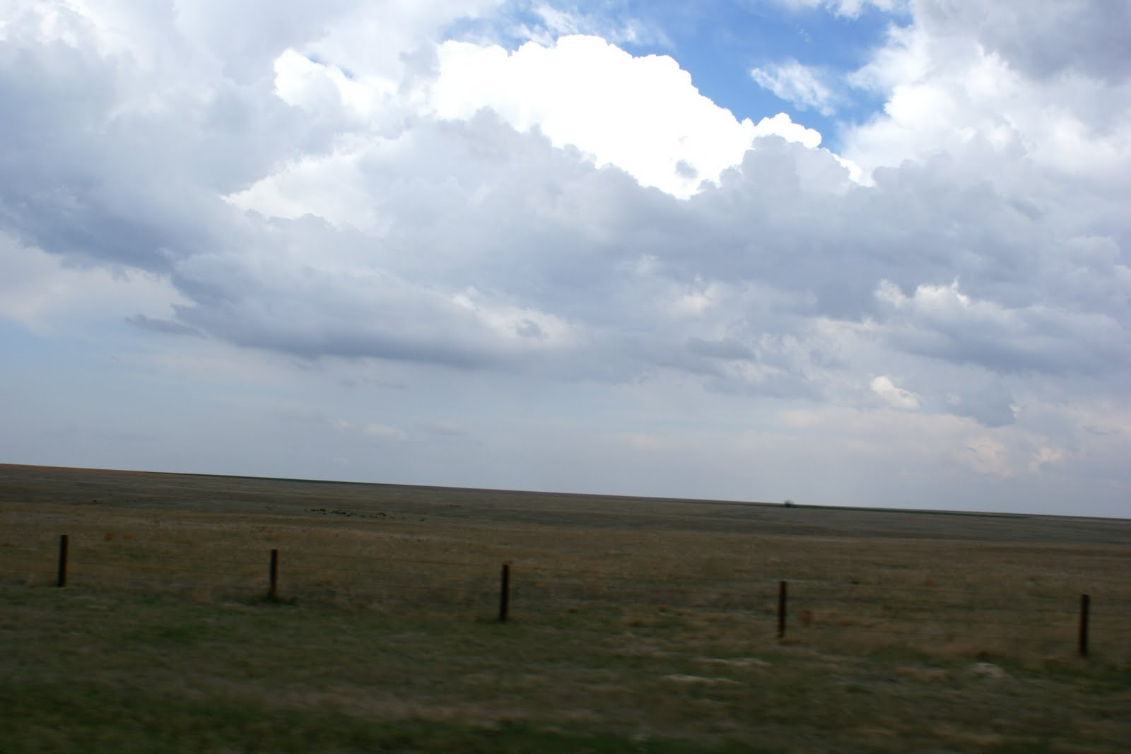
The sky in Dodge City was clear but the temperature was warming up. The problem was you could tell we were west of the dryline as the humidity was very low. Not a good sign if you are looking for thunderstorms.
 |
| Just a dry looking skyline in Western Kansas. |
Towering cumulus were being reported in NW Kansas closer to the track of a surface low pressure center coming out of Colorado, so off we went. Our window was closing as it was approaching mid afternoon. We crossed the Arkansas River and there was not a drop of water in the section we saw. Quite different from what we see in Little Rock.
 |
| As we traveled north through West Kansas we started to see cumulus building to our north. |
 |
| Cumulus starting to build higher in the West Kansas sky. |
As we approached Oakley Kansas we could see developing thunderstorms to our east and NW. We turned west at Oakley and headed for extreme West Kansas. At the same time a couple of thunderstorms went tornado warned in NE Colorado and we were getting kind of excited. On our way west, we encountered two dust devils so we knew the atmosphere was trying to tell us something. Cell service was kind of spotty on this trip but Verizon held up rather well for our data collection.
We turned north at Sharon Springs and were working our way towards Garden City. About halfway on radar you could see thunderstorms developing on radar in association with a boundary and this would prove to be our target area. Temperatures south of the boundary were still warm but north of it, well that was a different story. As we stopped for gas just south of Interstate 70 near Garden City we could see a fairly potent storm to our south drifting to the north, so we quickly got into position for any possible devleopment. It looked promising but just didn't deliver.
 |
| Storms starting to build in NW Kansas |
 |
| This storm caught our attention but it didn't produce anything. |
 |
Erich and the Silver Lining Tour group looking at the storm coming up from the south. Notice the jackets..
temperatures were in the mid 50s. Not exactly what you want to see for tornadoes. |
We headed back to Garden City and then west towards Burlington Colorado. There were several thunderstorms to our west and three of then were tornado warned. We could see for miles in this country so we took a shot. On our way we encountered a developing thunderstorm that we were watching very close. We passed on it for another cell to our NW and this one would deliver a wall cloud and small funnel. This was just to the east of Burlington.
 |
This storm caught our eye on our way to Burlington, but we let it go so we could get on a more
promising storm to our NW. |
 |
| Wall cloud just east of Burlington Colorado on I-70 |
 |
| Trying to get a funnel going. |
 |
| As the first funnel dissipated a new lowering appeared on the wall cloud. |
We quickly moved west of the storms and then turned north in Burlington to intercept them from the south. The storms were rather slow movers so we had plenty of time to get ahead of them. While moving north, we encountered a hail shaft. The hail covered the road in front of us but for the most part it was pea to marble size so it didn't cause any damage to our Jeep. As we were moving north we saw the TIV (Tornado Intercept Vehicle) and it appeared they were either setting up a camera or getting ready to deploy a probe of some sort. There were chasers up and down the road we were on in anticipation of this storm spawing a tornado.
 |
| Hail covering the road. |
 |
| The TIV |
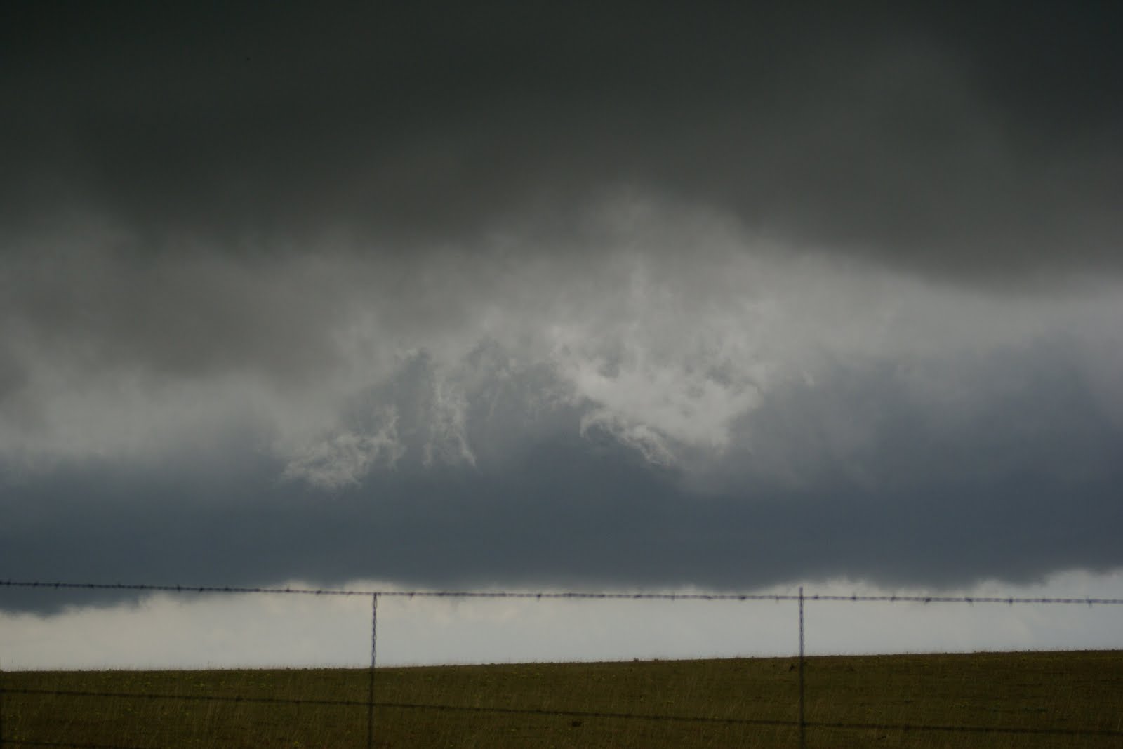
We finally located a great spot to get a closer look at the storm. While it edged closer to us we could see a well defined rotation to it and small funnels were rotating around. We thought for sure that this would produce a tornado but with temperatures on the north side of the boundary in the upper 40s to low 50s it was not to be. Everyone piled out of the Jeep and van and took pictures and video of the mesocyclone. No tornado but we were in perfect position. If one had occurred with this storm we would have been about 5 yards from the touchdown.
 |
| Rotation with the thunderstorm (hard to tell) |
 |
| Look close to the center and you can see a swirl indicating a small funnel. |
 |
| Silver Lining Tour guests taking pictures and video. |
 |
| Taking video of the mesocyclone. That's Todd in the blue shirt. |
 |
| Funnel trying to form. |
After the storm moved to our north, everyone took off to intercept another storm coming up fromt the south. The TIV and crew blew past us and then we left.
 |
| TIV and crew moving N. Notice the hail shield on the Discovery Channel Crew vehicle. |
We drove north for a few miles then turned east and waited on the next storm. We encountered some large hail (slightly larger than quarters) and some what I would call snowballs falling from the sky. They were hail but when they hit the windshield just broke apart like a snowball would. Weird. We got into position to intercept the storms and one of them had a small funnel with it but mostly hail, rain and a lot of lightning.
 |
| Storm lowering and moving toward us. |
 |
| Can really tell in the picture but that middle section is a hail shaft. |
 |
| Taking video of the storm. |
 |
| Erich capturing an image of a small funnel |
 |
Between the two telephone poles in the center of the picture
a funnle is trying to lower. |
 |
| After the storm moved through, we saw the TIV once again heading to the east. |
Once the last storm moved through we said goodbye to Colorado and prepared for the long drive home. We headed east, then south to Goodland Kansas, then east again on I-70 where we spent the night in Hays Kansas.
 |
| The long road home from Colorado.... |
We ate breakfast in Hays then loaded up for Arkansas on Thursday morning. It was amazing to us after leaving the Silver Lining Tour group and heading back that we just so happened to stop at the same hotel they were staying at in Hays.
On our way back we came across a large wind farm in the middle of Kansas. And when I say large I mean LARGE. It was several miles wide and long. We stopped to take a few pictures to share.
 |
| Kansas wind farm between Hays and Salina |
 |
| A closer look |
 |
| Kansas wind farm |
Once at Salina we turned south and headed for Wichita where we stopped for lunch. We noticed we picked up a little Colorado dust on the Jeep so I decorated the window.
 |
| Photojournalist Philip Labuda and Todd taking a break |
 |
| Storm Safari hunters..Todd, Erich and me. |
We left Wichita and were watching radar closely as thunderstorms were developing over Eastern Oklahoma and Arkansas. We thought we might get in once last little chase before home. But most of the storms were away from our route. We made it back into the LR area around 6:30 that evening.
All in all..I would say the trip was a success. Todd got his story or stories and I got to chase in the plains. Total miles traveled: 1685 Tornadoes:0 Funnels:4 Wall Clouds:2 Hail: a bunch. We ate plenty of junk food and it was good!!!
 |
Storm Safari Route: Little Rock,AR to Tulsa OK-Wichita KS-Dodge CityKS-OakleyKS-Goodland KS-Burlington CO-
St. Francis KS, Goodland KS, Hays KS, Salina KS, Wichita KS, Tulsa, Little Rock 1685 miles |
I am ready to go back and in fact planning a trip for early July to the northern plains, or maybe I'll just wait on a landfalling hurricane along the Gulf Coast. Hmmmmm maybe I'll do both.
Ninja
For more information on chasing vacations with Silver Lining Tours click the link below:
www.silverliningtours.com
Don't forget to follow me on Twitter at
www.twitter.com/weatherninja